Originally published to facebook.com/NorthPlattePL on April 8, 2022.
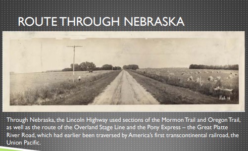
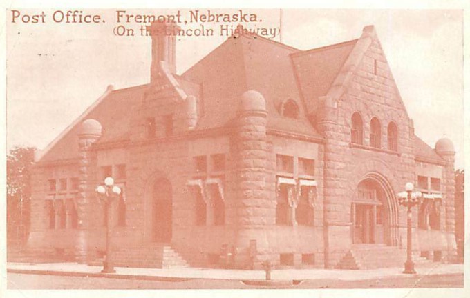
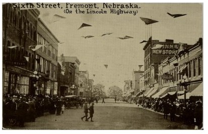
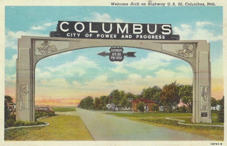
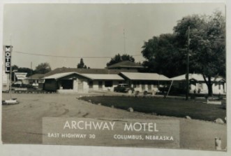
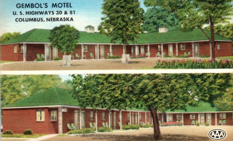
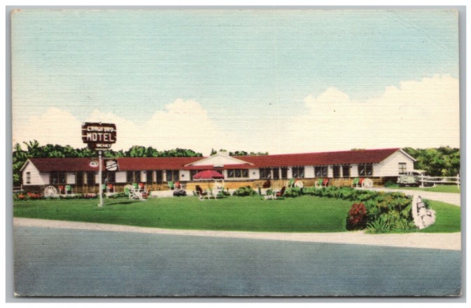
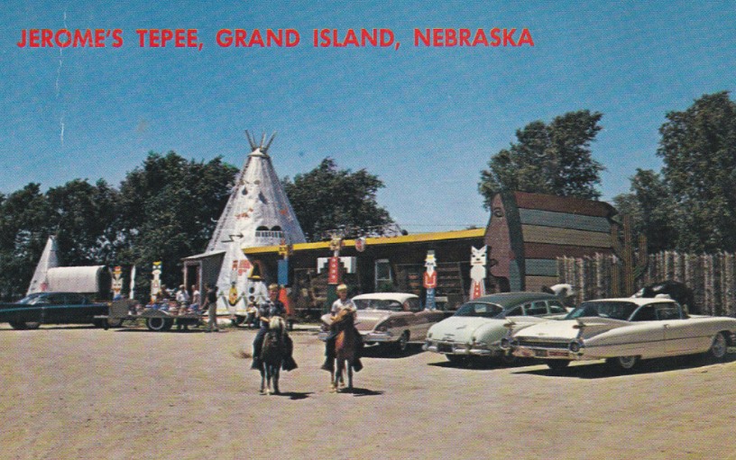
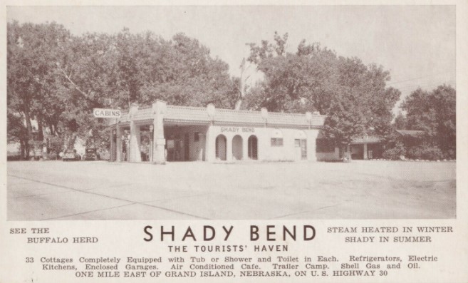
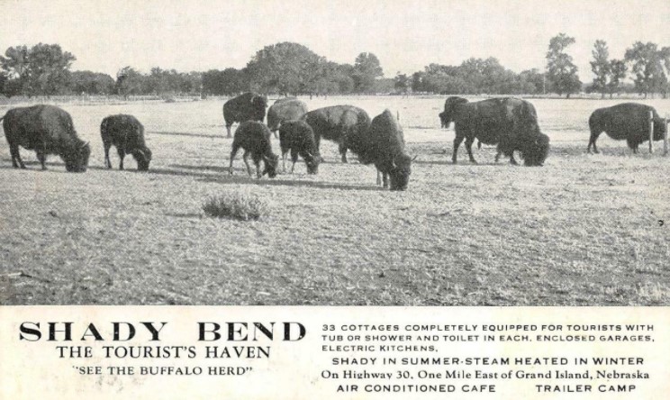
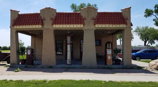
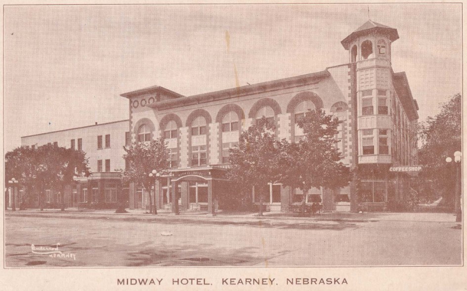
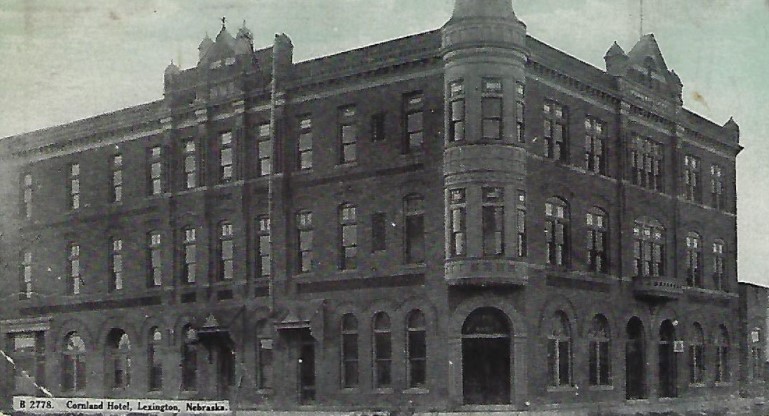
This post contains Lincoln Highway/Highway 30 postcards from across the state of Nebraska (east to west)! This would be a great summer trip to take–see what buildings are still there, discover Nebraska!
Originally published to facebook.com/NorthPlattePL on April 8, 2022.
Last Friday, we took a look at Lincoln Highway/Highway 30 coming through North Platte and Lincoln County. This week, we look at the development of “auto courts” in North Platte along the Lincoln Highway and one unique Nebraskan automotive family, popular in the 1930’s-1950’s. I am guessing this is the one article that many readers have been looking forward to!
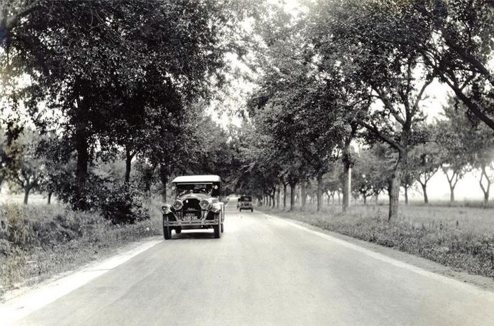
Early motorists also had to contend with where to spend the night because the speed limit was 20 miles per hour, meaning that a trip would take several days to make. So travelers would often they pitch tents and cook outdoors; or stay in motor courts or cabins.
For some, this was an economical way to travel; for others it was part of the adventure as Warren Belasco described in “Americans on the Road.” Belasco referred to the early decade of automobile travel (1910-to 1920) as the “gypsy years.” In 1915, Travel magazine ran a series which described the Lincoln Highway from coast to coast. The writer claimed that travelers would find a “superb, swift trail, gleaming before them, the world’s greatest open road,” and that camping could prove to be one of the “chief attractions for travelers on the Lincoln Highway and finally, “camping equipment, cooking utensils and water, become necessary factors, once the tourist leaves Omaha, for the remainder of the journey west.
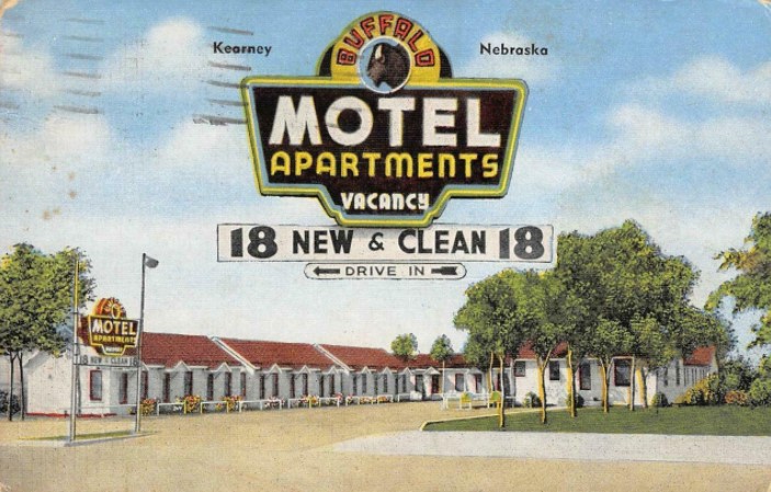
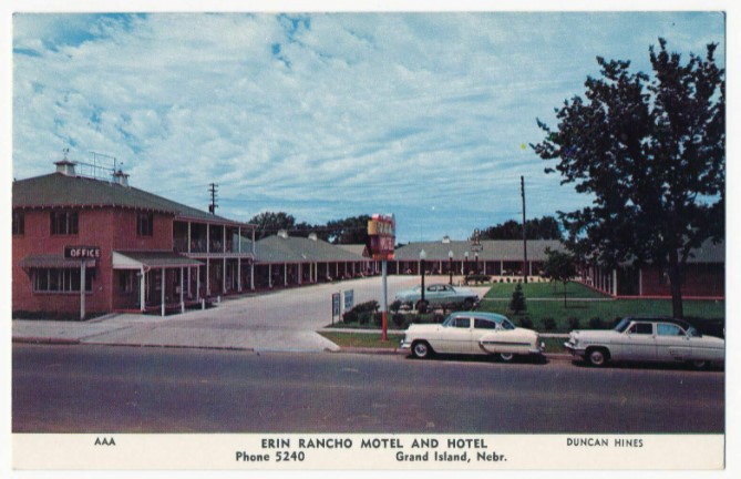
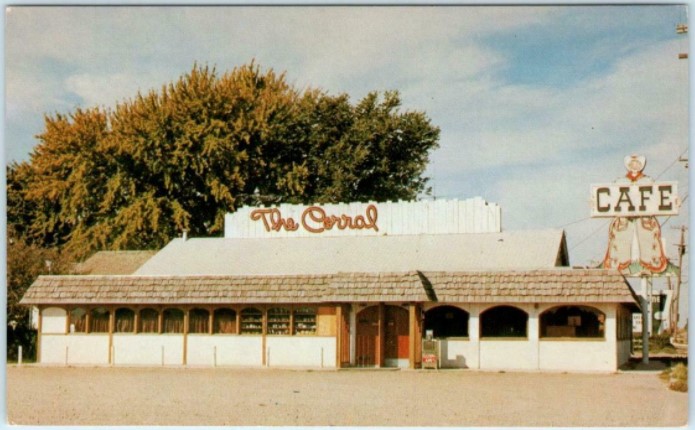
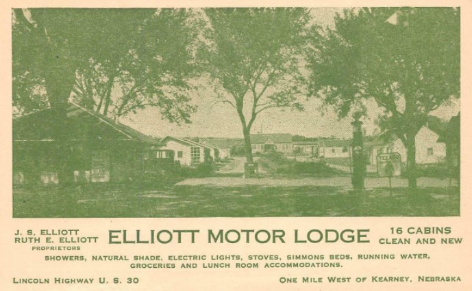
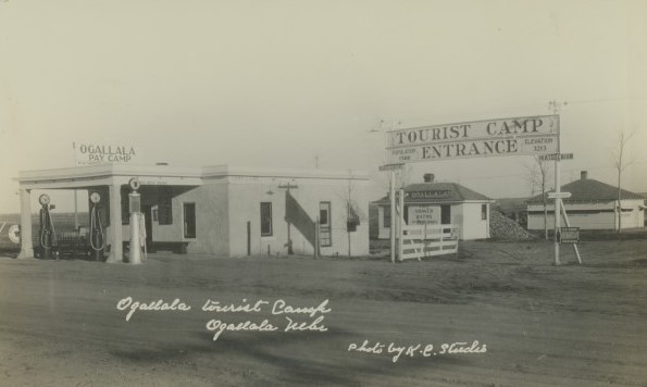
For those who chose not to camp, existing hotels in cities and larger towns along the route were the only accommodations. New ones soon developed however, such as the “tourist home” which consisted of a room rented in a private residence. Other accommodations included the auto-camp or tourist camp or auto court, which soon developed into the cabin camp. In Nebraska, but about 1930, almost every town on a numbered highway advertised at least one. The term auto-court or motor court or motel are often used interchangeably. The auto-court consisted of a small cabin to stay and secure your belongings and a parking space for your car out front.
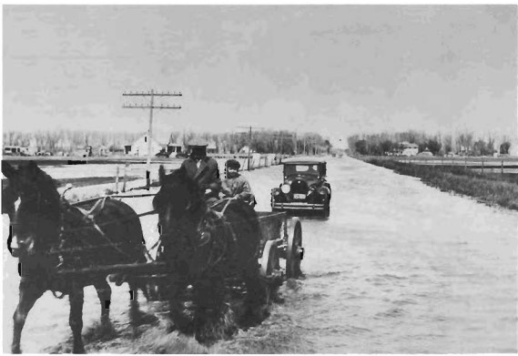
By early 1924, the North Platte Chamber of Commerce started receiving requests for auto camps and places to stay. Business people got together and started opening up “auto camps” for tourists. One of the first camps to open was the Chamber Auto Camp Ground, which opened from April 15-Oct 1 of 1924. During this time 4,644 cars parked overnight. The camp had an open building with stoves and sinks with running water; a caretaker; and bathrooms. Although the ended up the year over budget, it was decided to charge 25 cents per night to cover the costs.
Initially an area for pitching tents, these camps soon included a group or row of simple frame, one room cabins. A tourist who stayed at one in Nebraska in the mid-1920’s described it on a postcard, “Dear Mother: This is a sample of the camping grounds we find. Only some places charge fifty cents. We have traveled close to 150 miles so far today… We are so dirty. It has been so warm and dusty. The tiny black flies are as bad as the mosquitoes.”
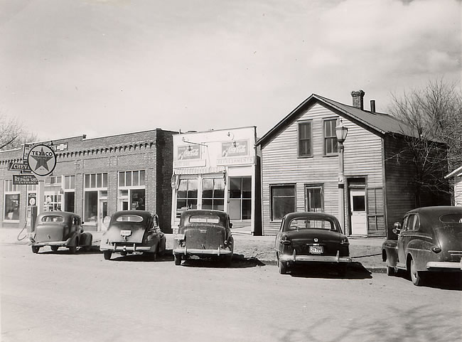
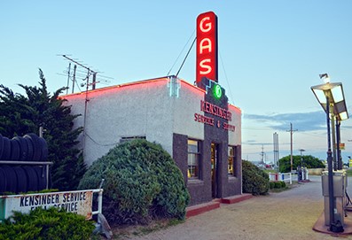
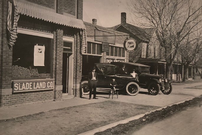
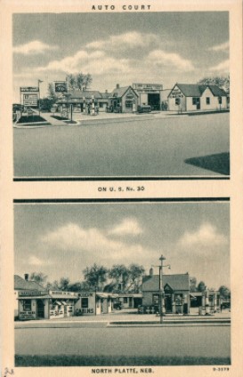
By 1928, travelers coming through North Platte had plenty of places to get gas and oil, and spend the night. Following the highway through the city, they would pass 19 service stations, the last being on 12th Street (Rodeo Road) and Buffalo Bill Avenue. This equated to approximately 3 miles of gas stations. Most of the downtown stations were located on business corners. All sold gasoline and others sold related business items such as grocery, tires, or campgrounds.
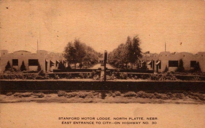
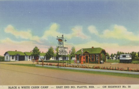
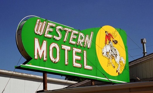
North Platte offered a number of motels on both ends of the city. On the east end, the Black and White Cabin Camp opened in the mid-1930s; each cabin had its own heat, toilet, and shower. On the west end is the nicely kept Cedar Lodge, with Spanish styling and a shaded central courtyard. The Western Motel was once connected to the building next door, when it was the Western Café and Bar-B-Q. Both motels still sport beautiful neon signs. In 1939 WPA guide noted that the town had six hotels and six principal tourist camps, along with rooming houses and smaller camps.
On June 26, 2013, Kaycee Anderson wrote an article “Lincoln Highway jutting through Lincoln County,” highlighting the motels and camps along the Lincoln Highway for the Lincoln Highway Association’s Centennial for the North Platte Bulletin. The rest of this post is taken from Kaycee’s newspaper article:
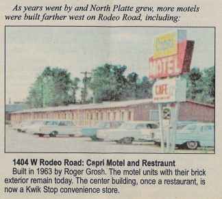
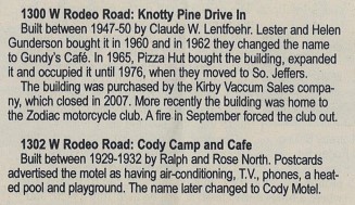
“…Today, Lincoln Highway signs are prominent in the RV camp at the west end of Rodeo Road where a blues music festival will be held July 19-20, and on a boxing club building on the corner of Rodeo Road and Adams and at the Lincoln Highway Diner at Rodeo Road and Willow. With a closer look, one can still see motels, gas stations and former trading post buildings along Rodeo Road. Some buildings have changed and are hardly recognizable. Many have been torn down.” Here are a few of the motels that were highlighted:
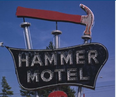
421 W Rodeo Road: Cedar Lodge
Built by Harold Rasmussen in 1940: A 1956 postcard advertised 30 rooms with tile baths, combo tub and showers in each room, TV, air-conditioning, telephones and a free radio. All rooms had garages and there was a shady beautiful lawn to enjoy, which remains today.
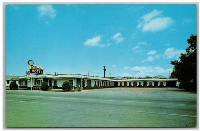
615 W Rodeo Road: El Rancho Motel
Built between 1942-1943, a postcard dated 1950 advertised the motels 12 units with tub & showers, gas steam heat and Beauty-rest beds. A later postcard advertised El Rancho with a heated pool, play area and golf course. The motel is still in operation.
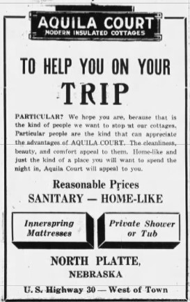
706 W Rodeo Road: Aquila Court / Western Motel
Built between 1936-38 by J. Robert Derryberry. In 1950 it was bought by Vigil Egle who changed the name to Eagle Motel. In 1954 Egle changed the name to the Western Motel, Café and BBQ. A postcard dated 1952 advertises the motel with 16 units.
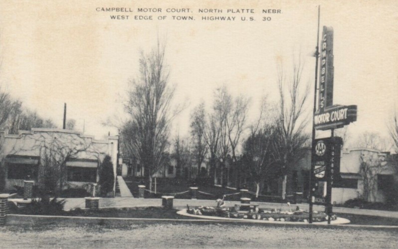
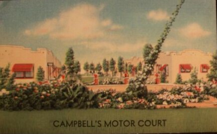
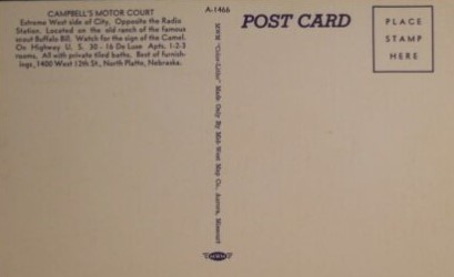
1420 W Rodeo Road: Campbell’s Motor Court
Built in 1938. The North Platte Daily Bulletin reported that Guy R. Campbell from Denver came to North Platte to build the most modern tourist camp in the US”. Campbell built 12 cabins with garages, kitchenettes, tiled showers, specialized woodwork and floor coverings. The kitchens and baths would have inlaid linoleum. All cabins would be insulated and weather stripped. Campbell said, “most of the material for the cabin court was purchased from North Platte firms and all the work was done by North Platte craftsmen and laborers. I have traveled a good bit during the past few years inspecting auto courts in various parts of the country. All the new ideas I have been incorporated with some ideas of my own to make this tourist court one of the nation’s best.” The motor court was bought in 1962 by Fred L. Burke who changed the name to Rambler Court, Burke remodeled the cabins by taking out the garages to create 16 deluxe apartments, advertisements said. Burke also added a heated pool and playground near the highway. Today the pool has been filled but is still visible. The court is H&H Apartments.
BONUS HISTORY!: Please enjoy looking through the second post with postcards from Highway 30 across Nebraska!
Originally published to facebook.com/NorthPlattePL on April 1, 2022.
Last Friday, we looked at the history behind the establishment of the Lincoln Highway/Highway 30. This week, we look at how Highway 30 coming through North Platte affected our community and county. Next week we will look at the development of “auto courts” in North Platte along the Lincoln Highway and one unique Nebraskan automotive family, popular in the 1930’s-1940’s.
Some of the highlights of today’s post include;
The early concerns that the route of the Lincoln Highway would be along the southern part of the state (Omaha, Lincoln, Hastings, McCook);
The improvements and “straightening” the route over the years;
The Army Convoy of 1919;
The marking of the Lincoln Highway by the Boy Scouts of America; and,
The last concrete completion of the Lincoln Highway road took place just west of North Platte
If you remember, the year was 1912 and most roads were dirt or sand and didn’t necessary connect. The purpose of the original Lincoln Highway was to connect the roads, create one road that would connect the East and West coasts, and a project that would improve this road. Once this movement had momentum, 1913 was a very busy year in the planning for the Lincoln Highway to go through North Platte:
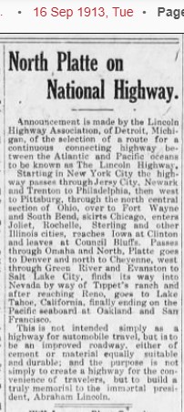
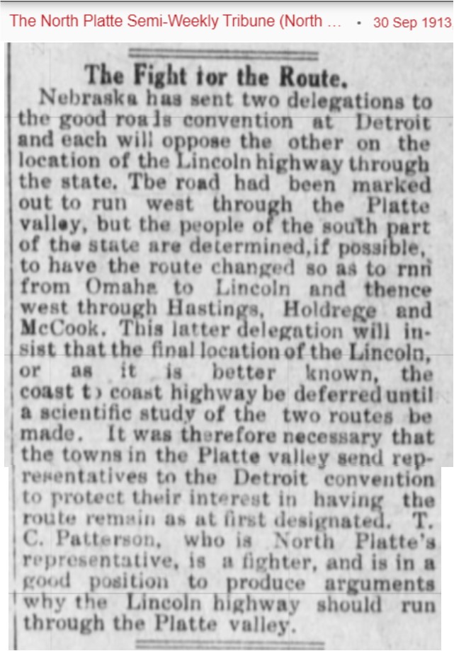
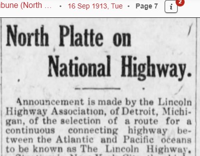
Sept 16, 1913 – North Platte found out that the Lincoln Highway would come through the state of Nebraska.
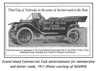
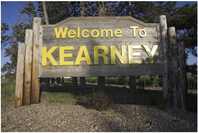
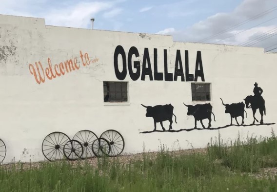
Sept 18, 1913 – The proposed route of the Lincoln Highway through Nebraska would be: Omaha, Fremont, Columbus, Central City, Grand Island, Kearney, Lexington, Gothenburg, North Platte, Ogallala, Big Springs, Chappell, Sidney and Kimball.
Sept 26, 1913 – A Lincoln Highway Convention (called the Good Roads Committee), would be held in Detroit, Michigan in about 4 days, and delegates were invited to attend. Thomas C. Patterson was elected as local North Platte/Lincoln County delegate and left immediately for Detroit.
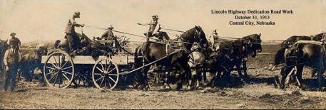
Sept 26, 1913 – The Platte Valley Transcontinental Highway Association met in Central City, Nebraska on October 8, 1913. The purpose of said meeting was to provide ways and means of raising about $2,000 per mile for the Lincoln Highway across the state.
Sept 30, 1913 – Thomas Patterson reported from Detroit that the route through Nebraska was not definitely set, and that there was a petition movement proposing that Highway 30 go through the southern part of Nebraska: Omaha, Lincoln, Hastings, and McCook, then on to Denver. Remember that Denver was excluded from the original Lincoln Highway and as a political good-will gesture, a loop was originally put in and then taken out later.
Oct 3, 1913 – At the Good Roads meeting in Detroit, it was decided that the location of the Lincoln Highway through Nebraska would follow the Transcontinental Route (through North Platte). The decision was made because there were more existing roads to connect, the Union Pacific already had connection points due to the railroad, and it was a more direct route. With the routes near the Union Pacific, it was hoped that the UP would help fund the roads, and they did. The delegates also got to see the concrete roads around Detroit and it was hoped that the Lincoln Highway roads would be improved to be concrete roads. Another topic discussed at this meeting was the cost needed to get the Lincoln Highway started. That target funding goal was ten million dollars. The plan was to have businesses, individuals, and communities started fund-raising campaigns for the construction.
Oct 7, 1913 – Articles ensued about the cost of the Lincoln Highway. The average cost through Nebraska was going to be about $8,000 per mile. And the road through Lincoln County would be nearly sixty miles in Length and the cost would be over $450,000.
Oct 17, 1913 – The Lincoln Highway Commission requested that in locating the road through Nebraska, all turns, if at all possible, must be eliminated in order to shorten the route.
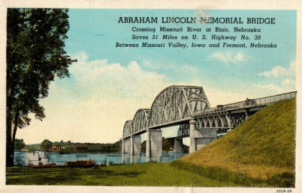
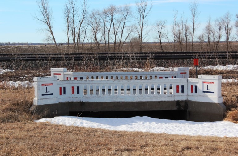
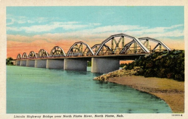
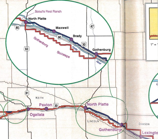
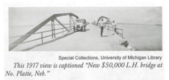
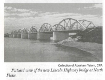
Oct 26, 1913 – The original route from Gothenburg to North Platte was planned as a “stair step” road, changing directions every few miles. It was suggested that if a permanent bridge were constructed east of North Platte, it would save 18 miles and be a more direct route. The cost for the bridge would be $50,000. Twenty-five thousand dollars would come from the state; $12,500 would be paid through a levy by the Union Pacific Railroad; and the remaining $12,500 would come from the people of six eastern Lincoln County precincts and the residents of North Platte. The bridge construction meant that the Lincoln Highway route would be straightened and shortened. Thereby making Highway 30 coming into the city on East 4th Street, not Jeffers Street.
Researchers Note: In case you are wondering, why would the Highway between Gothenburg and North Platte have the “stair step pattern?” Well, the railroad owned much of the land that the Lincoln Highway was following and because part of the original intent was to “see America,” the Highway went through many towns and villages. So the road winded through the towns, utilizing the existing roads and railroad crossings, and created the stair-step. If you look at the map, you can easily see why the straightening of the route was more desirable than the stair step.
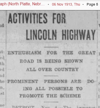
Nov 7, 1913 – The bond issue for the new $50,000 bridge passed at the County Commissioners meeting. Researchers note: although the bridge bond passed, it was a few years before the bridge was completed and the Lincoln Highway route changes (that happened around 1915/1916).
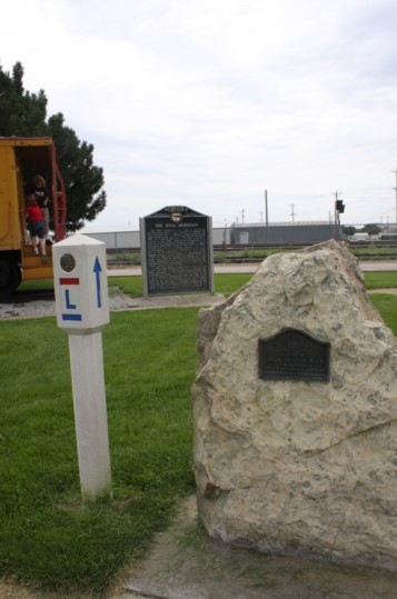
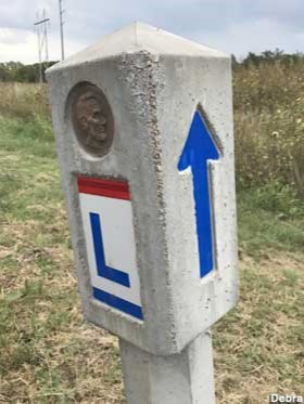
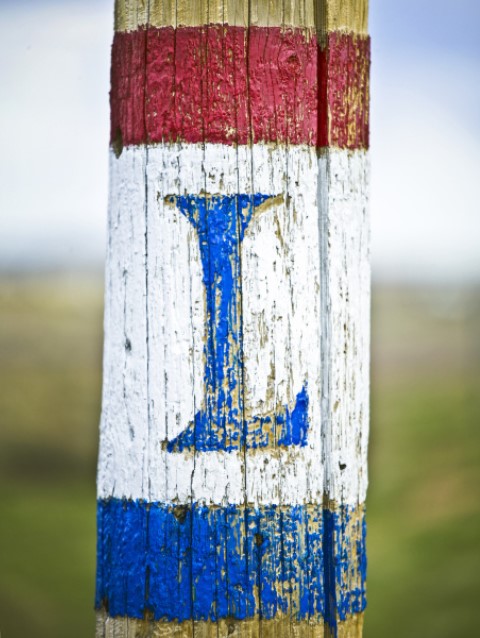
Dec 4, 1913 – Lincoln Highway Marker colors and designs were selected. The official Lincoln Highway marker stands 21 inches high, and consists of a strip of red three inches high at the top, a white band 21 inches wide and a strip of blue three inches high below the white. On the white background in blue there is a large letter “L” and the words “Lincoln Highway” in smaller type. This marker is to be painted on telegraph poles, barns, fences whatever is available along the highway and which can be readily seen by the tourist.
By 1914, there still wasn’t much of a highway to be concerned about. No improvements had been made to the Lincoln Highway; there was a growing disinterest of people; and the ten-million-dollar fund was stalled at the half-way point. The Highway through Lincoln County is still mainly dirt and sand.
Over the next few years, the road was straightened and the new route was called the 2nd Generation Lincoln Highway.
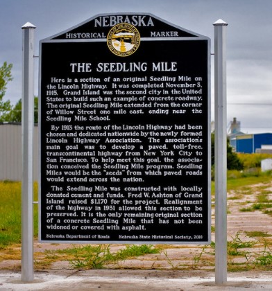
One of the most successful promotional activities of the Association were called “seedling miles.” With cement donated by the Portland Cement Company and funds raised by local sponsors, one-mile concrete sections were constructed in Ohio, Indiana, Illinois, and Nebraska. On November 3, 1915, Grand Island became the first Nebraska city to complete a seedling mile. Kearney’s was finished two weeks later. Lincoln County did not complete a seedling mile, which may have been a blessing in disguise, as ALL the seedling miles in Nebraska needed repairs after one year.
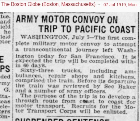
In 1919, the government decided to see if a military convoy could traverse the United States from coast to coast, and planned to use the Lincoln Highway for the majority of the trip. They left on July 7, 1919 and the convoy consisted of 42 trucks, including ambulances, repair shops and kitchens. This was the first motor convoy to attempt a transcontinental journey, starting in Washington and ending in San Francisco. The goal was to complete the journey in 60 days. The convoy was reviewed by Secretary of State Baker and a number of Army officers. The purpose of this trip is to develop a through route from coast to coast for motor transport. See attached newspaper article from the Boston Globe: “Army Motor Convoy on trip to Pacific Coast.
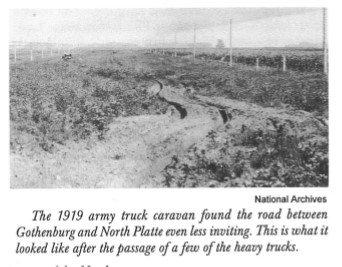
The convoy came through Nebraska during the last days of July 1919. A crowd gathered in Omaha and applauded to welcome the men, among them, General Dwight D. Eisenhower who had recently returned from the Great War. This caravan did not set out to stir up patriotism, though. Rather, the U.S. Army wanted to see if the new transcontinental highway could withstand the weight of military vehicles.
The men in charge of the Army convoy described the trip as rough, and the caravan broke almost every bridge it encountered. An article in The Gothenburg Times, August 6, 1919 had the headline “Army Motor Convoy has first setback in Dawson County Mud: Troop Train Arrived Saturday afternoon after Rough Voyage from Lexington in Mud and Rain. Trip to North Platte Sunday Worse and More of it. Across the United States, the Lincoln Highway road’s weaknesses were made apparent. During his presidency three decades later, Eisenhower instituted the bill that approved the Interstate Highway System. This time in the transcontinental convoy, along with experience with the German Autobahn during World War II, influenced him to establish the interstate highway system (I-80) we know today.
During the 1920’s many of the Lincoln Highway roads continued to be improved by replacing dirt/sand sections with concrete, and the route was “straightened.” As you can see on the attached map, some areas of the state have a third generation straightening. Former Nebraska Department of Roads engineer Walt Heier claimed that the most significant road improvements occurred after 1932.
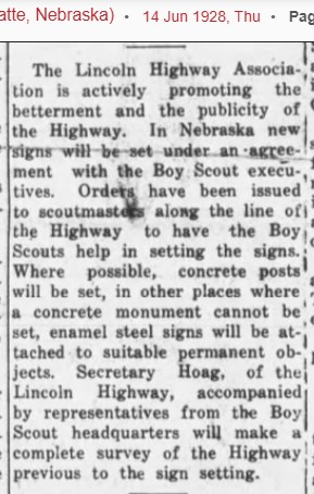
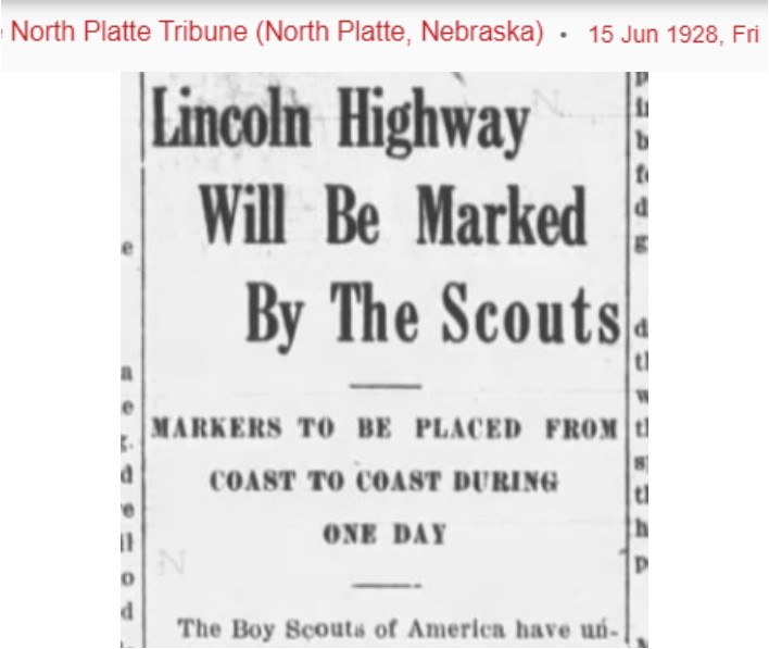
In 1928, the Boy Scouts of America decided to assist in the placing of Lincoln Highway permanent markers in every state. The work was done under the direct supervision of the national committee on safety of which Col Theodore Roosevelt was chairman. Thirty-five Lincoln Highway markers were put up in one day in the fourth week in August. After the marker was installed, the care and maintenance of the marker was assigned to an individual boy scout. On July 25, 1928, a caravan of seventeen Boy Scouts came through North Platte. These boys were selected for general all-around achievement and character from the United States to represent the National Council of the Boy Scouts of America. The object of their tour was to promote the Lincoln Highway Safety program and proper marking/designation of the highway.
And the story of the Lincoln Highway comes full circle with a twist of irony. North Platte/Lincoln County was one of the first in the United States to ratify the Lincoln Highway Proclamation in 1913, but ironically, it was the last place that the Lincoln Highway was paved. In early November 1935, over 3,000 people gathered on Route 30, a few miles west of North Platte. In a nod to the transcontinental railroad’s “Golden Spike,” a golden ribbon was cut. The celebration included a caravan of automobiles, covered wagons pulled by oxen, horse-drawn buggies, and a stagecoach. President Franklin Roosevelt sent a telegram, “Completion of the last link of pavement on U.S. Route 30 is an event of such importance that I am happy to send my congratulations. The perilous trail of the pioneers is at last transformed… into a coast-to-coast highway.”
The highway that had begun as a red line on paper was finished. Today, adventurous travelers can still find Highway 30, the old road, markers, and buildings; from both the original, second and third generation Lincoln Highway.
And if you want to read more about the Lincoln Highway, stop by the Library and check out some wonderful books!
Join us next week as we look at the invention of auto-courts in North Platte for visiting travelers on the Lincoln Highway!
Originally published to facebook.com/NorthPlattePL on March 25, 2022.
Over the next three Fridays, our Facebook Friday posts will look at the development of transportation and the impact on North Platte:
March 25, 2022: The history behind the Lincoln Highway/Highway 30;
April 1, 2022: Highway 30 comes through Lincoln County and North Platte;
April 8, 2022: The development of “auto courts” in North Platte on the Lincoln Highway and one unique automotive family;
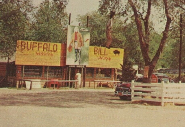
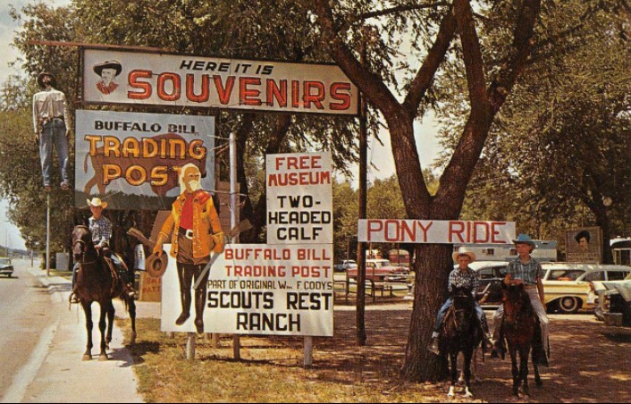
April 15, 2022: the history behind Buffalo Bill’s Trading Post (originally located on Rodeo Road/Highway 30), now known as Fort Cody Trading Post.
Let’s start with the history behind the Lincoln Highway. Read on!
The Lincoln Highway was one of the most famous transcontinental highways, stretching from New York to California. Let’s turn the clock back to before we had the Lincoln Highway and how folks traveled.
In 1912, the definition of a “good” road was one that was graded. Most gravel and brick roads were found in the cities, which means that the open roadways were basically just dirt and sand. Remember, this was before asphalt and concrete roads, so an “improved” road was gravel or brick. In North Platte, the majority of the roads in town were dirt on top of sand, and the country roads were all sand; with North Platte’s downtown being brick streets. America boasted some 2.5 million miles of roads, however most of these dirt/sand roads didn’t connect. These roads were bumpy; dusty in dry weather and impassible mud pits during the rainy or snowy seasons. Travel by train was much easier for the traveling public when going from one town to another.
Now, the thought of developing a connected road system, especially between the coasts had been discussed since about 1902, mainly by Automotive manufacturers.
The American Automobile Association was trying to find support for a road that would connect coast to coast, but finding financing and a labor force to do the work were some serious obstacles to overcome. And the idea was pretty much talked about and considered, but nothing happened.
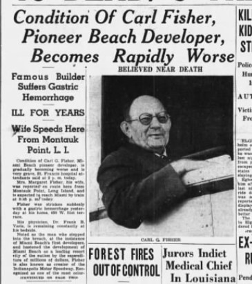
Then, in 1912, Carl Fisher emerges with a plan to build a highway called the Coast-to-Coast Rock Highway. And Mr. Fisher was a man who would turn his dreams into reality. So who is Carl Fisher?
Carl Graham Fisher (1874-1939) was born on January 12, 1874 to Albert and Ida (Graham) Fisher in Greensburg Indiana. Carl was considered an American entrepreneur. He was actively involved in automobile racing and a tireless supporter and promoter of the automotive industry.
He called his idea the “Coast-to-Coast Rock Highway.” The cost would be about ten million dollars, low, even for 1912. Communities along the route would provide the equipment and in return, would receive free materials and a place along America’s first transcontinental highway. The highway would be finished in time for the 1915 Panama-Pacific Exposition and would run from the exposition’s host San Francisco, to New York City.
To fund this scheme, Fisher asked for cash donations from automotive manufacturers and accessory companies of one percent of their revenues. The public could become members of the highway organization for five dollars.
Fisher knew that the success of the ten-million-dollar fund would depend on the support of Henry Ford. Unfortunately, even after many persuasive attempts by friends and close associates, Ford would not support the project. The public would never learn to fund good roads if private industry did it for them, Ford reasoned.
This put the fund in jeopardy; and there would not be enough time or money to finish the highway by the exposition in 1915. Fisher would not give up, especially since the country had become so enthusiastic about the highway. Two men from the automobile industry who pledged money to Fisher’s idea would later play major roles in the highway’s development: of Frank Seiberling, president of Goodyear; and Henry Joy, president of the Packard Motor Car Company
In fact, it was Henry Joy that came up with the idea of naming the highway after Abraham Lincoln. He wrote Fisher urging him to write a letter of protest to Congress which was considering spending 1.7 million on a marble memorial to Lincoln. Joy thought that a good road across the country would be a better tribute to the president. The name “Lincoln” captured Fisher’s fancy; and, he realized it would give great patriotic appeal to the highway. Fisher asked Joy if he wanted to be involved directly with the highway project. At first Joy was hesitant, but he soon wholeheartedly supported the project and became the primary spokesman for the highway.
On July 1, 1913, the association decided to call the coast-to-coast highway the Lincoln Highway, and it was officially incorporated as the Lincoln Highway Association. Henry Joy was elected as president. Carl Fisher, who was elected vice-president, was not present. He had departed with the Indiana Automobile Manufacturers association on a trip to the West Coast. The “Hoosier Tour” was intended, in part, to explore possible routes for the Lincoln Highway. The tour route included Colorado and Kansas. While Fisher tried to distinguish the Hoosier Tour route from the eventual route of the Lincoln Highway, he all but promised the governors of Colorado and Kansas that the highway would pass through their states. They were set up for a big disappointment.
Fisher kept the route of the Lincoln Highway a secret as long as he could because:
1) he wanted the nation as a whole to support the highway, not just the states through which it would pass, and;
2) he didn’t know what the final route would be. No decision had been made. After Hoosier Tour, the association decided they needed to pick a route.
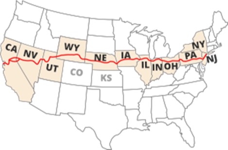
As far as Joy was concerned, directness was the most important factor. By bypassing many scenic attractions and larger cities along the way, narrow winding roadways and congestion could be avoided. After weeks of deliberation, Henry Joy presented the route before the annual Conference of Governors in Colorado Springs. The highway started in Times Square in New York City. It passed through New Jersey, Pennsylvania, Ohio, Indiana, Illinois, Iowa, Nebraska, Wyoming, Utah, Nevada, and California, ending in Lincoln Park in San Francisco. The route did not deviate from a straight path in order to go through larger cities or national parks. It did not touch Kansas or Colorado. Joy’s influence for a direct route was clear.
The governors of Colorado and Kansas were embarrassed for having heartily supported the Hoosier Tour, only to find themselves bypassed. After forceful appeals from Colorado’s governor, the association agreed to a dogleg from Big Springs, Nebraska southwest to Denver, and then back to the main highway at Cheyenne. After the route was announced to the public one month later, the decision to include the dogleg would come back to haunt them.
Almost immediately, the Lincoln Highway Association received letters trying to change the route; it politely declined every request. The association learned its lesson. Two years later, it dropped the Denver dogleg from its maps and guides and warned drivers not to be misled by signs in Big Springs pointing them to Denver.
The Lincoln Highway Association set up a system of people along the highway that acted as local ambassadors. They would represent the highway in local affairs, assist visitors, and let the headquarters know of matters concerning the highway.
By 1914, there wasn’t much of a highway to be concerned about. No improvements had been made to the original Lincoln Highway, and with Ford’s refusal to chip in and growing disinterest of people left off the route, the ten-million-dollar fund that Fisher had set up had stalled at the halfway point. Joy decided to abandon the fund and instead redirect the association to a new goal: educating the country for the need for good roads made of concrete, with an improved Lincoln Highway as an example.
It would oversee the construction of concrete “seedling miles” way out in the countryside to emphasize the superiority of concrete over unimproved dirt. As people would learn about concrete, they would press the government to construct good roads throughout their state.
In March 1925, the American Association of State Highway Officials (AASHO) started planning a federal highway system. Major east-west routes would be numbered in multiples of ten, from U.S. 10 across the north to U.S. 90 across the south. The major north-south routes would end in 1 or 5, from U.S. 1 between Maine and Florida to U.S. 101 between Washington and California.
The Lincoln Highway was then broken up into U.S. 1, U.S. 30, U.S. 530, U.S. 40 and U.S. 50. The Lincoln Highway Association was created in 1913 to promote the Lincoln Highway using private and corporate donations. Americans’ enthusiasm for good roads led to the involvement of the federal government in building roads and the creation of numbered U.S. routes in the 1920s. The Federal Highway Administration and the Interstate Highway System are the culmination of these efforts.
Carl G. Fisher became a very wealthy man in 1913, when he sold his patent for acetylene headlights to Union Carbide for 9 million dollars (equivalent to $240 million dollars in 2021). Carl Fisher married Jane Watts and they had two children together: Benjamin Walker Fisher (1891-1908) and Carl Graham Fisher Jr (1921-1921). In 1927, he married Margaret Eleanor Collier in Virginia. Fisher was not a devoted family man and dedicated his life to his entrepreneurial interests. Fisher eventually lost his fortune in the 1929 Stock Market Crash. He ended up living in a small cottage in Miami Beach doing minor odd jobs for old friends. Although he lost his fortune, Fisher is widely regarded as a very successful man, when viewing his entire life. He had many accomplishments that impacted the history of America. Fisher died on July 15, 1939 from a gastric hemorrhage in Miami Beach, Florida at age 65.
Next week we will look at the Lincoln Highway being constructed and coming through North Platte—both the original and the second generation/ improved highway. Thank you for reading!
And if you want to read more about the Lincoln Highway, stop by the Library and check out some wonderful books on the subject!
Originally published to facebook.com/NorthPlattePL on March 18, 2022.
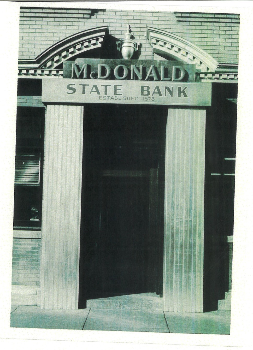
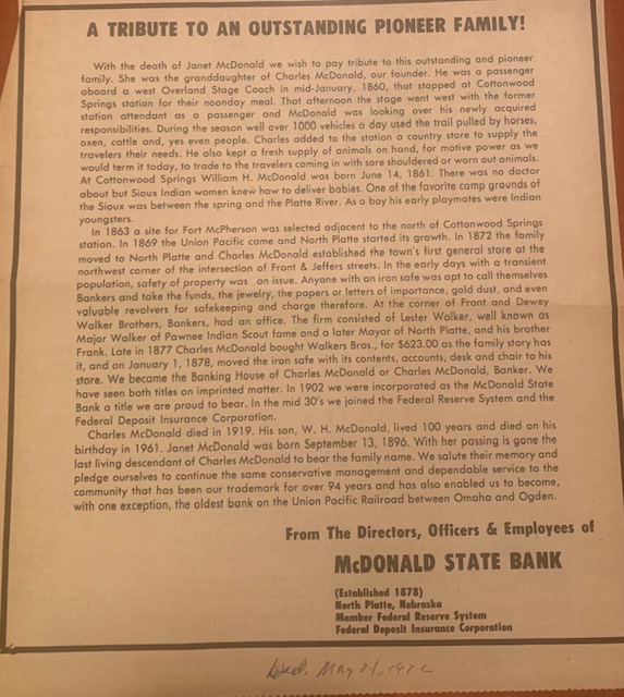
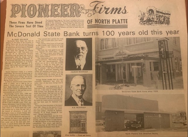
For this week’s Facebook Friday history, we have decided to reprint part of Mary Ann Koch’s article from the North Platte Telegraph, from Sunday, January 15, 1978. The main article is entitled “McDonald State Bank turns 100 years old this year,” and focuses on remembrances of living bank presidents in 1978, but also provided an interesting history. So, let’s start with some early bank history, enjoy!
Article Title: Bank of 1878 had no deposits, no checks, no loans, just an iron safe
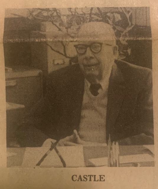
Editor’s note: The following letter was written in December 1977 by J. Y. Castle, chairman of the board of McDonald State Bank, and the following history was written for the bank directors.
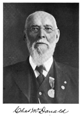
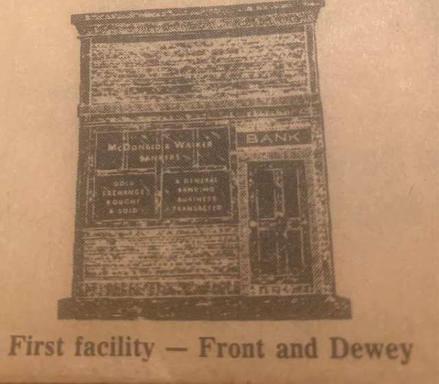
“We are coming to the close of another successful year. We are also ending our 99th year of banking. It was on January 1, 1878, that Charles McDonald moved North Brothers Bankers into his store located in a log building at the southwest corner of 6th and Jeffers Streets, where the Shrake Body Shop is now located.
With his brother he had established North Brothers Bankers. For $532, he sold Charles McDonald the bank fixtures, consisting of a desk and chair, an iron safe and its contents. A bank back then was a completely private business. There were no deposits, no checks, no loans, no supervision, and it was entirely a place for the safekeeping overnight or longer of whatever a person had of value for a fee.
There were no hotels in North Platte and the only lodging available for travelers were rooms on the second story of downtown buildings, and there were only a few of them. Keys and locks were unknown then and there were no single rooms available. If a man or woman obtained a room, one of the same sex would also be assigned to the room, all of which had double beds, if they checked in late and the place was full.
Therefore, people passing through would pay to put valuables into a safe or private place and this included not only gold dust and money, but such things as expensive hand guns, boots, etc.
Coach station at the mouth of Cottonwood Canyon in 1861 on the Oregon Trail which daily carried a thousand vehicles, more or less of all descriptions in season. Later Fort McPherson was established next to the state station and store he had developed. He moved into North Platte in 1872 when the railroad was completed across the plans and Rock Mountains.
There was still traffic on the Oregon Trail, but it was getting smaller with each succeeding year.
After the move, Charles bought a section of railroad land for $2.50 an acre that now includes the southwest part of North Platte. To build the railroad, the government gave the UP every alternate section of land, 640 acres for 6 miles either side of the right-of-way. Nowadays, people constantly run to Washington for money for such developments and other purposes, as we have nearly exhausted our natural resources. When I came to the bank in 1936, there was still nearly 300 acres left of the railroad section. It was divided into city lots and the land was selling for the equivalent of $800 per acre and the last went much higher, as high as $1,500 per acre.
The land Charles McDonald purchased of UP was bounded on the north by A Street, which is on the section line, and McDonald Avenue which is on the north-south center of the land. It is all in the city limits.
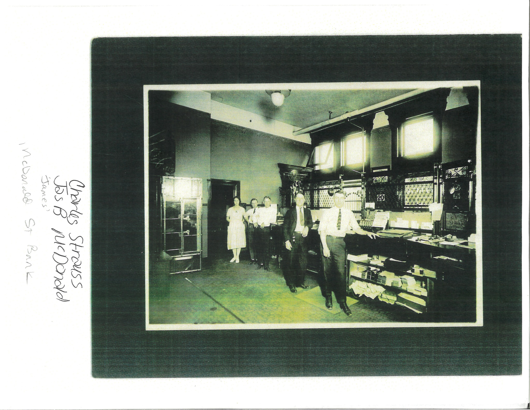
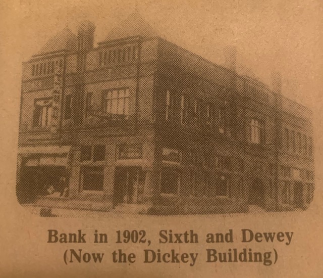
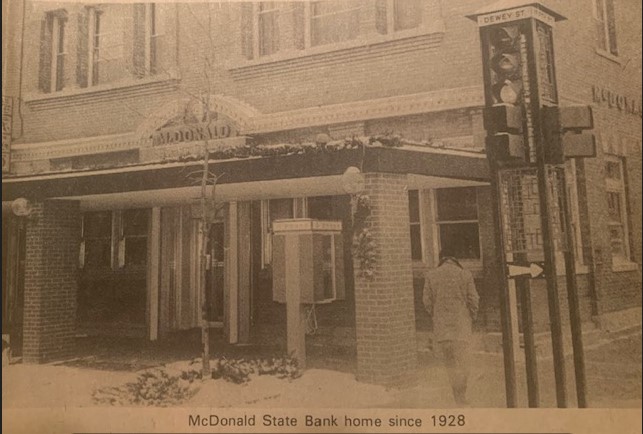
In the hundred years our capital funds from the purchase price have increased to approximately 3 million dollars, all from earnings. We were incorporated in 1902 as the McDonald State Bank. The State of Nebraska had no Banking Department until the late 1890’s. Since 1934, we have paid dividends regularly, each and every year.
With competent management, the bank can look forward to another 100 years of profitable operation for its condition is very sound.”